Temporal Data Management in TSQL Queries
Explore the realm of temporal data in TSQL queries, delving into the concepts of valid time and transaction time, different types of relations like snapshot and bi-temporal, and the significance of time dimensions in database management. Learn how temporal databases support time-related queries for
7 views • 41 slides

Localised Adaptive Spatial-Temporal Graph Neural Network
This paper introduces the Localised Adaptive Spatial-Temporal Graph Neural Network model, focusing on the importance of spatial-temporal data modeling in graph structures. The challenges of balancing spatial and temporal dependencies for accurate inference are addressed, along with the use of distri
6 views • 19 slides
Spatial Database Systems: An Overview
This presentation by Xiaozhi Yu introduces the fundamentals of spatial database systems, covering topics such as spatial data types, relationships, system architecture, modeling, and organizing underlying spaces. It delves into the importance of integrating geometry into DBMS data models, spatial in
8 views • 30 slides
The Spatial and Temporal Distribution of Temperature
The spatial and temporal distribution of temperatures plays a crucial role in determining weather patterns, climates, vegetation zones, and wildlife habitats. Factors such as latitude, altitude, distance from the coast, and prevailing winds influence the distribution of temperature both horizontally
6 views • 5 slides
Behavioral Data Analysis During Saccadic Eye Movement Task
Visual systems utilize saccades to focus on objects, impacting temporal perception. This study explores the effects of saccades and stimulus location on perceived time, presenting findings from an experiment on temporal perception mapping with fixed visual duration. The method of psychometric functi
2 views • 12 slides

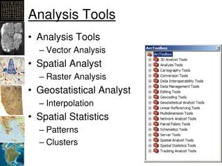
Spatial Analysis & Modeling for Spatial Planning Training in Maputo, Mozambique
Explore spatial analysis techniques for efficient route planning, site selection, pattern identification, and value prediction in the context of spatial planning. Learn about surface modeling, relationships among features, and the importance of spatial modeling in addressing geographical problems.
0 views • 27 slides

GIS Data Models for Spatial Planning Training in Maputo, Mozambique
Explore the concepts of GIS data models including vector vs. raster, spatial relationships, spatial operations, and representation of real-world entities in a spatial database. Understand how spatial data models are used to manipulate spatially-referenced information and define the spatial location
3 views • 32 slides
Spatial Autocorrelation in Geostatistical Analysis
Explore the concept of spatial autocorrelation, its implications in geostatistical analysis, and the importance of detecting and interpreting it correctly. Learn about auto-correlation, signal components, correlation significance, and measuring autocorrelation using tools like Moran's I. Gain insigh
7 views • 12 slides
Discussion on Temporal Entities and Simultaneity in CIDOC CRM Meeting
Temporal entities and the modeling of simultaneity in CIDOC CRM are under discussion at the upcoming meeting. The current approach considers the cardinality of certain relations, aiming to streamline the representation of time-spans and spacetime volumes. The evolving perspectives on the spatial com
5 views • 5 slides
Temporal and Spatial Information Models
This content delves into the intricacies of temporal and spatial information models, covering concepts such as existence, presence, and spatiotemporal relationships. It explores how entities are identified, events are witnessed, and durations are defined within these models. The interplay between ti
6 views • 9 slides
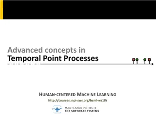
Advanced Concepts in Temporal Point Processes for Human-Centered Machine Learning
Explore advanced concepts in temporal point processes through the lens of human-centered machine learning. Topics include marked temporal point processes, independent identically distributed marks, dependent marks, and mutually exciting marks. Learn about stochastic dynamical systems such as the Sus
5 views • 8 slides

Enhancing Spatial Data Analysis in QGIS
Explore the integration of relational databases with QGIS to facilitate efficient spatial data analysis. Discover the importance of recognizing spatial relationships within data sets and the solutions to enhance QGIS for relational datasets. Overcome challenges and delve into the intersection and su
1 views • 25 slides
Overview of Temporal Data Models and Time Dimensions in Databases
Explore the concepts of temporal data models and time dimensions in databases, covering topics such as data structures, query languages, different timestamp types, valid time, and transaction time. Learn about the importance of supporting various time aspects in database systems and the complexities
1 views • 52 slides
Spatial and Temporal Scales in Science Education
This research delves into the emphasis on spatial and temporal scales of Earth and Space Science processes in K-8 science standards and textbooks. The study analyzes systematic coding and analysis techniques and explores how these concepts are portrayed in various educational materials. It also exam
3 views • 8 slides

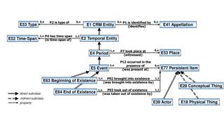
Entity and Event Relationships
This schema represents the relationships between entities, events, time spans, spatial information, and more. It outlines how entities are identified, events occur within time spans and places, and the existence of physical things is defined. The concepts of beginning and end of existence, spatial a
2 views • 9 slides
Temporal Quality Assessment for Mobile Videos
This research focuses on developing a novel Temporal Variation Metric (TVM) to assess the temporal quality of mobile videos. The approach aims to accurately measure temporal information without the need for optical flow methods, making it suitable for embedded devices. The methodology, including the
4 views • 20 slides

A Spatial Perspective
Spatial perspective is a crucial aspect in various fields, including geography, architecture, and urban planning. It involves understanding the relationships and patterns of physical spaces and their influences on human activities and environments. By adopting a spatial perspective, professionals ca
5 views • 23 slides
Discussion of COGO Spatial Data Report Card at ASPRS Rio Grande Chapter Annual Spring Meeting
The ASPRS Rio Grande Chapter Annual Spring Meeting in 2015 featured a presentation by Earl F. Burkholder on the COGO Spatial Data Report Card, evaluating the National Spatial Data Infrastructure (NSDI) framework and its management issues. The report card graded the framework on data themes and manag
2 views • 10 slides

Probabilistic Database Model
This research explores the development of a temporal-probabilistic database model to handle uncertain temporal facts obtained from information extraction methods. Motivated by the need for scalable query engines and a lack of unified approaches supporting both time and probability aspects, the study
3 views • 21 slides
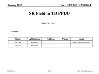
Spatial Reuse in IEEE 802.11 - Overview and Proposal
This document explores the concept of spatial reuse in IEEE 802.11 standards, particularly focusing on the 11ax and 11be amendments. It discusses the benefits of spatial reuse, proposing enhancements for better utilization of spectrum and improved efficiency in wireless communications. The proposed
1 views • 6 slides
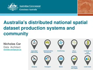
Australia's Foundational Spatial Data Framework Overview
Covering Australia's distributed national spatial dataset production systems and community involvement, the Foundational Spatial Data Framework (FSDF) is a government initiative aimed at streamlining the production of national spatial data products. Coordinated by Geoscience Australia, FSDF plays a
0 views • 40 slides

Geostatistical Distances Analysis in Spatial Studies
Geostatistics, a branch of statistics focusing on spatial datasets, plays a crucial role in various disciplines like geology, hydrology, and agriculture. Tobler's First Law of Geography forms the foundation of spatial analysis, emphasizing the relationship between proximity and interaction in spatia
2 views • 6 slides

Extracting Dense Regions from Hurricane Trajectory Data
This research paper discusses the extraction of dense regions from hurricane trajectory data using spatio-temporal analysis techniques. The study explores the application of DBSCAN algorithm and temporal extension for clustering hurricane data based on spatial and non-spatial attributes. Experimenta
2 views • 21 slides

Mastering Spatial and Temporal Evaluation in A-Level Geography
Enhance your spatial and temporal evaluation skills as an A-Level geographer by delving into the importance of evaluating space and time, particularly within the context of the Australia Wildfires 2019. Understand spatial analysis, impact significance, and temporal evaluation scales to deepen your c
2 views • 13 slides
Enhancing K-12 Geoscience Education with Spatial Thinking Integration
Explore a framework for integrating spatial thinking into K-12 geoscience education, focusing on improving spatial thinking, constructive geography, and spatial-temporal primitives. Discover how a place-based curriculum can enhance spatial understanding across various science disciplines.
1 views • 26 slides

Contrastive Regression Transformer for Skill Assessment in Robotic Surgery
Explore the innovative Contrastive Regression Transformer model, Contra-Sformer, tailored for skill assessment in robotic surgery. This model focuses on expressing the similarity levels between surgical executions, enabling precise evaluation based on spatio-temporal deviations from a reference. Lev
1 views • 24 slides

Formal Systems and Temporal Logic for System Design
Explore the fundamentals of temporal operators, logic, and transition systems in formal system design, with a focus on the importance of temporal logic and its application in implementing logical specifications. Dive into the world of assertion IPs, temporal properties, and Kripke structures for a d
0 views • 88 slides

High-Resolution Temporal Spatial Applications with LGAD
Delve into the innovative design concepts like LGAD and RSD transforming silicon detectors for enhanced temporal and spatial resolutions. Explore the advancements made by INFN Torino in silicon sensor technology for improved tracking capabilities, utilizing LGAD-based detectors and FAST ASICs. Uncov
4 views • 37 slides
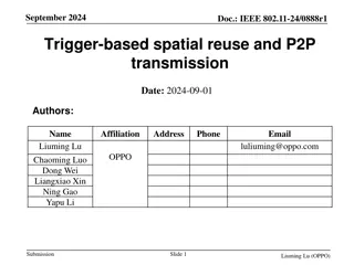
IEEE 802.11-24/0888r1: Coordinated Spatial Reuse for Enhanced WLAN Performance
Explore the proposal for trigger-based spatial reuse in IEEE 802.11-24/0888r1 document dated September 2024, focusing on improving WLAN reliability, throughput, and P2P operations through coordinated spatial reuse. The document discusses modes of spatial reuse, issues with PD/PSR-based operations, a
0 views • 10 slides

Novel Trajectory Compression Framework for Road Networks
Explore a cutting-edge trajectory compression framework that efficiently reduces the burden of storing and processing spatial trajectories in road networks. This innovative approach separates spatial and temporal information, proposing lossless spatial compression algorithms, error-bounded temporal
4 views • 17 slides

Bayesian Analysis of Spatio-Temporal Dynamic Panel Models
Explore the Bayesian analysis of spatio-temporal dynamic panel models with fixed and random effects. Learn about the spatial and temporal correlation in data and the estimation of covariance functions. See how these models are applied to analyze economic factors affecting crime data in Tehran city.
0 views • 32 slides

Innovations in LGAD and RSD Designs for High-Temporal Spatial Resolutions
Explore how the LGAD and Resistive Charge Division (RSD) designs have revolutionized silicon detectors, enhancing temporal and spatial resolutions. Discover the collaborative efforts behind these innovations and the implications for sensor and ASIC systems. Uncover the secrets to achieving good temp
1 views • 39 slides

Spatial Data Analysis in R: County Mapping and Operations Overview
Explore the world of spatial data analysis in R with a focus on county mapping and key operations. Learn how to work with spatial data, merge datasets, visualize maps, and perform basic spatial operations. Dive into examples and resources to enhance your spatial analysis skills.
0 views • 11 slides

Understanding Temporal Databases and Their Importance
Explore the world of temporal databases, from their motivation to comparisons with conventional databases, and delve into temporal data models, query languages, and indexing methods. Learn about transaction time databases, bi-temporal databases, and examples like sales data management.
3 views • 42 slides

Understanding Temporal and Spatial Information Models
Explore the intricacies of temporal and spatial information modeling, including concepts like time spans, events, beginnings, and endings. Discover how entities, places, and periods are interconnected in these models, offering a comprehensive view of data organization and relationships within spacet
1 views • 4 slides

Understanding Spatial Data Mining
Learn about spatial data mining, a process of uncovering interesting, useful, and unexpected spatial patterns within large databases. Discover why it is essential for gaining new insights into geographic processes and application domains, such as locating human settlements, identifying cancer cluste
2 views • 37 slides

Spatial Analysis Using Python: Key Tools and Techniques
Dive into spatial analysis using Python with an overview of spatial objects, tools, examples, and case studies. Learn about Shapely for geometric operations and Geopandas for handling spatial datasets. Discover essential sources and learn how to read different file formats for spatial data analysis.
1 views • 20 slides

Advanced Databases and Operations Overview
Explore advanced databases, data types, operations, and temporal data concepts as taught in Dr. Nicholas Gibbins' course. Learn about numerical, spatial, multimedia data types, and conduct meaningful operations on data including comparisons, arithmetic, and more. Dive into the structured world of da
4 views • 34 slides

IEEE 802.11-25 Spatial Re-Use & Nulling Interference Cancellation Updates
Explore the latest updates in spatial re-use and spatial nulling interference cancellation requirements within the IEEE 802.11-25 standard. Gain insights into coordinated spatial re-use versus coordinated beamforming, the necessity of spatial nulling in CoBF and CoSR frames, and the flexibility in i
0 views • 8 slides

Optimizing Spatial Temporal Data Visualization
Explore the implementation of efficient spatial-temporal data visualization using R*-trees to gain insights into geographic environmental data. Learn about the motivation, proposition, problem definition, proposed techniques, and tools used in this project.
3 views • 10 slides