Multibeam Data Analysis for Seabed Characterization at Deception Island, Antarctic
This work explores the morphological and sedimentary characterization of the seabed at Deception Island, Antarctic, through the analysis of multibeam bathymetric data and geological samples. The study identifies ravines, depressions, and volcanic structures as key features, revealing a seabed predom
0 views • 7 slides
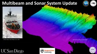
Update on Multibeam and Sonar Systems for USCGC Healy
The update for USCGC Healy includes recommendations for multibeam and sonar systems, such as utilizing either Kongsberg EM124 or EM304 with additions like shallow water mapping and EK80 Fisheries Sonar capability. Two high-resolution multibeam options are detailed: Option 1 pairs Kongsberg EM712 wit
0 views • 16 slides
Understanding Benthic Substrate Characterization Through Multibeam Bathymetry
Utilizing multibeam bathymetry and backscatter data, this project focuses on mapping potential benthic substrates in marine environments. The history, procedures, and possible classification schemes are discussed, highlighting the importance of analyzing backscatter data for sediment classification.
0 views • 28 slides


