Enhancing Geospatial Imaging Solutions with CARIS Tools for Seabed Mapping
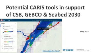
CARIS offers a suite of tools including CARIS Cloud and BDB Server, facilitating the seamless upload, processing, and transfer of bathymetric data to support initiatives like Seabed 2030 and GEBCO. The integration of CARIS tools enables stakeholders to manage, disseminate, and access hydrospatial da
0 views • 5 slides
Recent Developments in Marine Geospatial Information Management
The Baltic Sea Hydrographic Commission and related activities highlight significant developments in marine geospatial information management, including upcoming council meetings, GEBCO initiatives, and UN-GGIM endorsements of integrated marine geospatial frameworks. These efforts aim to enhance data
4 views • 8 slides
North Indian Ocean Hydrographic Commission - Annual Report Highlights
This report presents the highlights of the 19th Meeting of the North Indian Ocean Hydrographic Commission, focusing on achievements, challenges, progress on surveys and charting, capacity building requests, contributions to IHO DCDB and GEBCO, and plans affecting the region. It also discusses progre
0 views • 10 slides
GEBCO Technical Sub-Commission on Ocean Mapping (TSCOM) Overview
Technical Sub-Commission on Ocean Mapping (TSCOM) is a key component of the GEBCO program, established in 2006 to provide expertise in seafloor mapping and discuss emerging technologies. TSCOM serves as an authoritative source for bathymetric and hydrographic data and offers ongoing advice to associ
0 views • 12 slides
Highlights from 15th Conference of EAtHC, Lagos, Nigeria, 17-19 October 2018
Items discussed at the 2nd meeting of the IHO Council during the 15th Eastern Atlantic Hydrographic Commission Conference included ensuring use of the IHO Fund for Special Projects, coordination between RHCs, approval of IHO publication B-12 on Crowdsourced Bathymetry, elimination of overlapping ENC
0 views • 7 slides
International Reports and Proposals on Capacity Building and Maritime Safety
Explore reports on capacity building sub-committee's resource needs, investigating electronic navigation services, challenges in maritime safety information infrastructure in Africa, progress on GEBCO Project Seabed 2030, crowdsourced bathymetry initiatives, and advancements in marine spatial data i
0 views • 14 slides
