Understanding Vernier Scales and Precision Measurement Devices
Vernier scales, named after French cartographer Pierre Vernier, enhance precision in measuring even the smallest scale divisions. Instruments like the theodolite, slide calipers, and Fortin's barometer utilize vernier scales for accurate readings. Learn about key terms like least count and vernier c
5 views • 11 slides
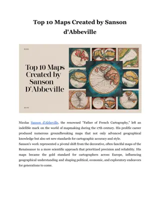
Top 10 Maps Created by Sanson d'Abbeville
Explore the top 10 maps by renowned cartographer Sanson d'Abbeville, showcasing his impact on historical mapmaking.
1 views • 5 slides
Ante Koli - Career Path and Achievements in Hydrography
Ante Koli, a dedicated professional from Croatia, excels in the field of hydrography as Head of System Support/Nautical Cartographer at the Hydrographic Institute of the Republic of Croatia. With a wealth of experience, Ante has contributed significantly to various projects, including creating navig
0 views • 9 slides
Career Insights from IHO Nippon Foundation Alumni Seminar
Lizardo Caro Martinez, a 2016 alumni from Colombia, shares his experience as a cartographer at DIMAR. He highlights his career achievements post-CAT B course, lessons learned, and offers suggestions for the future, emphasizing the importance of supporting maritime language development.
0 views • 5 slides
Exploring Kei Miller's "The Cartographer Tries to Map a Way to Zion
Kei Miller's collection offers a rich exploration of poetry, culture, and identity through the voices of a cartographer, a rastaman, and a narrator. The poems delve into themes of language, borders, and the poetic process itself, inviting readers to consider the intersections of literary, political,
0 views • 20 slides
Exploring Early Alabama: Europeans, Trade, and Native American Relations
In Chapter 2 of Discovering Alabama, the impact of French, Spanish, and English settlers on the Native American populations is explored. Key vocabulary such as immunity, bartered, cartographer, and more are highlighted. The lesson also delves into reasons for conflicts between Europeans and Native A
0 views • 69 slides
IHO Nippon Foundation Alumni Seminar - Abel Philip Ronald Lagivola
Self-introduction of Abel Philip Ronald Lagivola, a marine cartographer from the Republic of Fiji Islands, highlighting his role at the Fiji Hydrographic Office, career aspirations, projects, lessons learned from chart courses, and suggestions for the future. The content also includes images from th
0 views • 6 slides
Impact of 2020 Census on South Carolina Featuring Will Roberts, State Political Cartographer
The 2020 Census has significant implications for South Carolina, including revenue distribution and redistricting. Will Roberts, a state political cartographer, shares insights on the impact, emphasizing the $800 billion in annual federal government revenue, as well as the importance of representati
0 views • 8 slides

