Exploring the Landscape of Ancient Palestine
Discover the geographical features and historical significance of Palestine, the land where Jesus lived and ministered. From the coastal plains to the mountains and valleys, explore how this small country influenced world politics and provided routes for ancient trading centers. Learn about the divisions and districts of Galilee, Samaria, and Judea, rooted in history and cultural dynamics.

Download Presentation

Please find below an Image/Link to download the presentation.
The content on the website is provided AS IS for your information and personal use only. It may not be sold, licensed, or shared on other websites without obtaining consent from the author. Download presentation by click this link. If you encounter any issues during the download, it is possible that the publisher has removed the file from their server.
E N D
Presentation Transcript
Palestine It is impossible for us to be familiar with the life of Jesus without being familiar with the country where Jesus lived and ministered The land of Palestine was a small country, only about 140 miles long and about 40 miles broad. Palestine is situated at the eastern end of the great inland sea which the ancient regarded as being in the middle of the earth This land is a part of Asia and closely connected to Africa, in time it came to greatly influence the continent of Europe It is cut off to a large extent by the desert from the mighty empires of the East It lay astride the great highways upon which the trading caravans and invading armies traveled
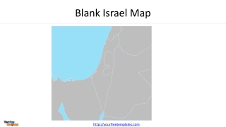
Palestine A fairly even line gives us the coastline with Mount Carmel jutting into the sea. That even line betrays the low-lying shores unbroken by safe harbors and gives us one of the external factors in the Jewish aversion to the sea. In the midst of the land surface there need be placed two irregular loops to represent the Sea of Galilee and the Dead Sea, and, connecting these, an irregular line, the River Jordan. The land of Jesus was the little strip of country between the River Jordan and the Great Sea. This narrow land is divided into strips fairly well marked in character. Bordering the Sea is a plain district which was never very closely identified with the real life of the Jews for it contained the great highways, north and south.
Palestine To the east lay the foothills and then the mountains. Here lay the real strength of Judaism Because of this location of being a bridge connecting three continents, the people of Palestine were forced into the currents of world politics
From West To East Maritime Plain Foothills Mountains Jordan Valley East Jordan Country Peraea
The Plain of Esdraelon Is a very fertile region It also provided routes for the highways which after skirting the shore of the Great Sea on the way from Egypt, here struck inland to the ancient trading center Damascus, and thence on to the Empire of the Tigris and the Euphrates Rivers.
The Three Chief Districts In The Days Of Jesus Galilee to the north Samaria to the south Judea to the south
These Divisions Had Their Roots In History Galilee and Judea were Jewish Samaria was inhabited by a people which while racially allied to the Jews was despised and hated by them The Jews while traveling north and south between Galilee and Judea generally crossed Jordan and traveled through Peraea rather than passing through Samaria.
The Jordan Depression One of the most remarkable geological phenomena on the earth's surface. From the point where the Jordan leaves the Sea of Galilee to the place where it enters the Dead Sea is sixty-five miles. The Jordan has a barrier of cliffs on either side from two to fifteen miles apart. The plain of Jericho, immediately north of the Dead Sea, is fourteen miles wide. By its windings the Jordan is about two hundred miles long Its width varies from eighty ton one hundred and eighty feet and its depth is from five to twelve feet
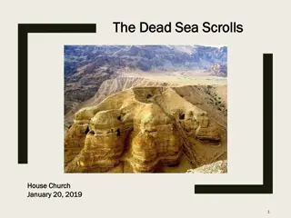
The Dead Sea Is forty-eight miles long with a maximum width of ten miles Its surface is 1,292 feet below sea level and reaches a depth of 1,300 feet.