Enhanced Spectral NITF Implementation Profile (SNIP) Version 1.2 Overview
This document outlines the Spectral NITF Implementation Profile (SNIP) version 1.2, its development, applications, and new elements. SNIP is a mandated standard for EO still imagery on DoD and IC systems, aiming to reduce integration costs and meet advanced exploitation needs for future HSI systems. Key aspects include functional requirements, collaboration with SMEs, and the NTB GWG JESC process. The new elements in SNIP v1.2 involve pixel vector image segments, band chipping, and lineage.
Download Presentation

Please find below an Image/Link to download the presentation.
The content on the website is provided AS IS for your information and personal use only. It may not be sold, licensed, or shared on other websites without obtaining consent from the author. Download presentation by click this link. If you encounter any issues during the download, it is possible that the publisher has removed the file from their server.
E N D
Presentation Transcript
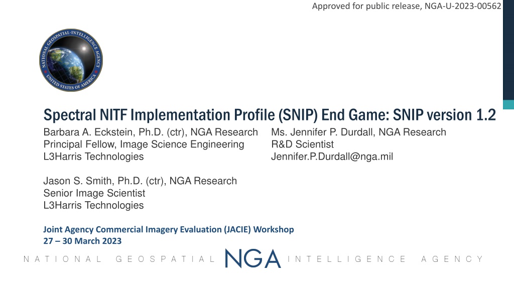
Approved for public release, NGA-U-2023-00562 Spectral NITF Implementation Profile (SNIP) End Game: SNIP version 1.2 Barbara A. Eckstein, Ph.D. (ctr), NGA Research Principal Fellow, Image Science Engineering L3Harris Technologies Ms. Jennifer P. Durdall, NGA Research R&D Scientist Jennifer.P.Durdall@nga.mil Jason S. Smith, Ph.D. (ctr), NGA Research Senior Image Scientist L3Harris Technologies Joint Agency Commercial Imagery Evaluation (JACIE) Workshop 27 30 March 2023
Approved for public release, NGA-U-2023-00562 SNIP Who, What, When, Where, Why, & How (5WH) Who? NGA Research and its contractor support, mostly from L3Harris and KBR What? A mandated standard for EO still imagery on DoD & IC systems, including the NSG Number of bands does not matter Applies to single band, MSI, HSI, . Applies to non-rectified & rectified imagery, independent of data provider When? Developed from 2017 to May 2023 (some funding gaps); SNIP adoption under way Where? In the NSG Standards Registry: both SNIP specification & example datasets Several ELTs are SNIP compatible, thanks to early roll-out of the RIPs Why?Because a single HSI standard will reduce integration costs. The 2011 HSI Profile (now retired) did not meet advanced exploitation needs of future HSI systems. How? Based on functional requirements: Invent as little as possible Subject matter expert (SME) collaboration: spectral stakeholders, photogrammetrists, NITFS SMEs, etc. NTB GWG JESC process: 18+ RFCs, 102 field value requests 1500+ comments adjudicated Lots of perseverance
Approved for public release, NGA-U-2023-00562 SNIP Version 1.2 Design: Physics-Based Description Purple Italics: v1.2 only Image Segments Pixel Quality (C) (C) File Header (R) Data Graphics (O) Text (R) Pixel Vectors (O) Quick- Look(s) (C) Spectral Image(s) (R) Pixel Lat/Lon (O) Pixel Height Pixel Metrics (O) Extensions (C) Clouds (O) Country Codes (C) Dataset Traits (R) File Mates (C) Sharing Controls (C) Geopositioning (R) Cloud Grid (R) TRE_OVERFLOW (C) Cloud Shapefile (R) Geopositioning (C) Pixel Conditions (R) Coverage Shapefile (O) Weather Data (O) Spectral Resp. Fn (O) Point Spread Fn (O) Et cetera Band Wavelength (O) Per Pixel IFOV (O) Sensor Azimuth Angle (O) Et cetera Airborne YES Airborne Legend Collection Data (C) Header Vector Information (R) Tagged Record Extension Image Segment Radiometry & Lineage Spectroradiometry (R) Band Chipping (C) Lineage (R) Illumination Data (R) Compression Data (C) Description & Discovery Graphic Segment Metric Information (R) Corner Coordinates (R/O) Target Data (O) Sensor & Quality Data (O) Exploitation Data (O) Text Segment Data Extension Segment C Conditional O Optional R Required New Elements in SNIP v1.2: Pixel vector image segments, band chipping, lineage
Approved for public release, NGA-U-2023-00562 SNIP Version 1.2 Design: NITF Segments and TREs (2 of 3) Purple Italics: v1.2 only Image Segments Pixel Quality (C) (C) File Header (R) Data Graphics (O) Text (R) Pixel Vectors (O) Quick- Look(s) (C) Spectral Image(s) (R) Pixel Lat/Lon (O) Pixel Height Pixel Metrics (O) Extensions (C) Clouds (O) CCINFA (C) CSDIDA (R) MATESA (C) SECURA (C) Geopositioning (R) CSCCGA (R) TRE_OVERFLOW (C) Cloud CSSHPB (R) GLAS/GFM DESs (C) PIXQLA (R) Coverage CSSHPB (O) WEATHER_DATA (O) Spectral Resp. Fn (O) Point Spread Fn (O) Et cetera Band Wavelength (O) Per Pixel IFOV (O) Sensor Azimuth Angle (O) Et cetera Airborne YES AIMIDB (R) ACFTB (R) Legend PXVECA (R) Header Radiometry & Lineage Description & Discovery CSCRNA (R) FCRNSA (O) MSTGTA (O) PIAIMC (C) PIATGB (O) USE00A (O) Tagged Record Extension Image Segment PIXMTA (R) BANDSB (R) BCHIPA (C) HISTOx (R) ILLUMB (R) J2KLRA (C) Graphic Segment Text Segment Data Extension Segment C Conditional O Optional R Required PIAIMC is required if a cloud cover image segment is present and the geopositioning CSEXRB TRE is not in the dataset
Approved for public release, NGA-U-2023-00562 SNIP Version 1.2 Design: Geopositioning Options (3 of 3)
Approved for public release, NGA-U-2023-00562 SNIP Implementation Considerations (1 of 2) The SNIP allows almost all NITF geopositioning options for EO imagery. Choosing the optimal geopositioning option(s) depends on functional requirements, including Is mensuration a requirement? Will FSTK be used to exploit the imagery? FSTK expects non-rectified imagery with lat/lon location grid. System Considerations File name conventions: Do the libraries allow only certain file name conventions? The NITFS has no standard for file names; NSG supports the SNIP recommended file name convention. Search and discovery: What metadata fields should be populated? For ex: cloud cover percent Is compression required? For ex: Storage and/or communication bandwidth issues? Timeliness: The system may function, but does it perform? For example: How long does it take for a file to be transmitted through the system? How long does it take for an ELT to upload an image? Image blocking parameters play a key role. How long does it take for an algorithm to produce results? Image segment order, and pixel order in the image segment(s), may affect performance
Approved for public release, NGA-U-2023-00562 SNIP Implementation Considerations (2 of 2) ELTs and Other Tools Analysts need tools that can understand the SNIP Few ELTs support all NITF support data extensions (SDEs, i.e., TREs & DESs) Data providers need to populate the NITF elements that the tools understand. Example: Some tools may understand only the RSM TREs, while others also understand the GLAS/GFM SDEs. Intermediate and End User Considerations Some analysts may need to extract imagery from the data chain before processing completes. For example, state of health analyses Some analysts may have limited bandwidth for downloading data File size still matters. Analysts rely on a recognizable sensor ID in the file name and in the metadata. Analysts often need to be able to parse the file name for information
Approved for public release, NGA-U-2023-00562 SNIP Implementation Example: Required Elements (1 of 2) Image Segments File Header (R) Text (R) Spectral Image(s) (R) Geopositioning (R) CSDIDA (R) Legend Header Radiometry & Lineage Description & Discovery CSCRNA (R) Tagged Record Extension Image Segment BANDSB (R) HISTOx (R) ILLUMB (R) Graphic Segment Text Segment Data Extension Segment C Conditional O Optional R Required
Approved for public release, NGA-U-2023-00562 SNIP Implementation Example: Functional Requirement Elements (2 of 2) HSI Data Image Segments Pixel Quality (C) (C) File Header (R) Data Text (R) J2K compressed Quick- Look(s) (C) Spectral Image(s) (R) Pixel Lat/Lon (O) Pixel Height Pixel Metrics (O) Pixel Vectors (O) Extensions (C) Clouds (O) FSTK users TRE Overflow Coordinated collects CCINFA (C) Geopositioning (R) ACCHZB (R) GEOPSB (R) GRDPSB (R) RSM TREs (R) CSEXRB PIXQLA (R) CSCCGA (R) TRE_OVERFLOW (C) CSDIDA (R) MATESA (C) RSM TREs needed Cloud CSSHPB (R) GLAS/GFM DESs (C) PIXMTA (R) Bad pixels known Data in NSG Cloud cover % known PXVECA (R) Geopositioning ACCVTB (R) GEOPSB (R) GRDPSB (R) AIMIDB (R) ACFTB (R) Cloud cover grid known Legend Header Radiometry & Lineage Description & Discovery CSCRNA (R) Tagged Record Extension Image Segment Per-pixel metrics needed BANDSB (R) HISTOx (R) ILLUMB (R) J2KLRA (C) Graphic Segment GLAS/GFM needed Text Segment Data Extension Segment C Conditional O Optional R Required PIAIMC is required if a cloud cover image segment is present and the geopositioning CSEXRB TRE is not in the dataset PIAIMC(C) Per-pixel vectors needed Airborne platform
Approved for public release, NGA-U-2023-00562 SNIP Conformant Reference Implementation Products (RIPs) Created from a single public domain Hyperion image: Baghdad, Iraq, 7 April 2005 SWIR focal plane array only, i.e., 172 of the original 242 bands Four RIP variants with different spectral image pixel order: BIB, BIL, BIP, & BSQ RIP 1.0B Series: SNIP v1.0, publicly released in the NSG Standards Registry HSI in a single image segment Quick-Look, Pixel Latitude/Longitude/Height, Pixel Quality, Pixel Metric Image Segments Geopositioning: GLAS/GFM SDEs RIP 1.1 Series: SNIP v1.1 conformant datasets New: RSM TREs; Cloud cover image segment, WEATHER_DATA & cloud shapefile DESs WEATHER_DATA is real, but cloud cover is fake because the image has no clouds. RIP 1.1A: Single HSI image segment In public release process RIP 1.1B & C: Segmented HSI & spatially chipped HSI respectively RIP 1.2 Series: SNIP v1.2 conformant datasets In work New content: BCHIPA & HISTOB TREs, Pixel vector image segment Dependent on NTB approval of these new TREs & image segment RIPs 1.2A, B, & C if resources permit Hyperion imagery courtesy of the US Geological Survey
Approved for public release, NGA-U-2023-00562 SNIP Conformance Verification: SNIP vs NITF Conformance NITFS conformance is a necessary but not sufficient condition for SNIP conformance. The SNIP has rules and requirements that are not part of the general NITFS. SNIP conformance tests include Presence of required SNIP elements in required sequence: Segments and TREs If conditions are met for a conditional file element, then test for presence & conformance of that element. Particular metadata field values are present and correctly populated. Geopositioning results are consistent when the dataset contains multiple geo-metadata sets Latitude/longitude grid vs RSM TREs vs GLAS/GFM SDEs vs Corner coordinates NGA/R funded L3Harris & KBR to create RIPs and SNIP conformance tests & tools In-house tools only; never meant to be a deliverable tool SNIP Abstract Test Suite (ATS): Most of the tests that determine SNIP conformance. SNIP v1.2 (draft) ATS contains 338 individual tests Not yet added to the ATS in draft SNIP v1.2: Chipped & segmented image tests
Approved for public release, NGA-U-2023-00562 Summary: The SNIP Is a Mandated Standard for Spectral Imagery in NITF The SNIP is a mandated DoD & IC GEOINT standard for spectroradiometric imagery, particularly MSI & HSI, encoded using the National Imagery Transmission Format (NITF) Standard (NITFS) NITF is a primary transmission format of the National System for Geospatial Intelligence (NSG) The SNIP replaces the now-retired 2011 airborne HSI NITF standard The SNIP applies to commercial, civil, and government data providers to the DoD and IC: Electro-optical (EO) still imagery collected by airborne, space-borne, and ground platforms Non-rectified, georectified, and orthorectified datasets Note: The SNIP may also be used for context imagery, such as panchromatic data Several systems have implemented or are implementing the SNIP, including commercial SNIP-conformant RIPs are freely available via the NSG Standards Registry If the NSG Registry is down, contact either the NTB (NTBChair@nga.mil) or a SNIP team member The SNIP work is almost done SNIP v1.2 is NGA Research s last iteration Low-cost integration & interoperability, plus high quality & utility, when EO datasets, especially MSI and HSI, conform to the SNIP
Approved for public release, NGA-U-2023-00562 SNIP Points of Contact For existing RIP datasets, go to the NSG Registry: 1. BIB - https://nsgreg.nga.mil/doc/view?i=5239 2. BIL - https://nsgreg.nga.mil/doc/view?i=5236 3. BIP - https://nsgreg.nga.mil/doc/view?i=5238 4. BSQ - https://nsgreg.nga.mil/doc/view?i=5237 Government Lead: Jennifer P. Durdall, Research Directorate (R) National Geospatial-Intelligence Agency (NGA) 571-557-2815, Jennifer.P.Durdall@nga.mil For SNIP training, contact Ms. Jennifer Durdall Dr. Jeff Stevens, Project Lead & POC for New RIP Generation Requests 571-557-6028, Jeffrey.R.Stevens.ctr@NGA.mil, Jeffrey.R.Stevens@L3Harris.com SNIP version 1.1, ID NGA.STND.0072_1.1_SNIP : https://nsgreg.nga.mil/doc/view?i=5316 If the NSG Registry is down, contact the NTB or a SNIP team member
