Geography of China: Territory and Administrative Units Overview
Explore the geography of China with a focus on its territory, provincial administrative units, and geographic location. Learn about the vast landmass, national borders, and key geographical features such as latitudes and coastal areas. This presentation serves as a foundational resource for understanding China's geography in educational settings.

Download Presentation

Please find below an Image/Link to download the presentation.
The content on the website is provided AS IS for your information and personal use only. It may not be sold, licensed, or shared on other websites without obtaining consent from the author. Download presentation by click this link. If you encounter any issues during the download, it is possible that the publisher has removed the file from their server.
E N D
Presentation Transcript
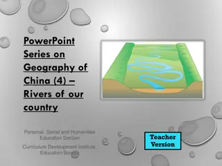
PowerPoint Series on Geography of China (1) The territory & provincial level administrative units of our country Personal, Social and Humanities Education Section Teacher Version Curriculum Development Institute, Education Bureau
Notes to Teachers The learning & teaching of Geography of China and its linkages with the Geography curricula The Geography Curriculum Guide (Secondary 1 - 3) and the Geography Curriculum and Assessment Guide (Secondary 4 - 6) have about 1/3 of their contents and examples on the physical and human geography of China. Before studying individual topics or examples related to geography of China, teachers should first teach this PowerPoint so that students can have a basic understanding of the territory and provincial level administrative units of our country. This helps students to learn the topics of geography of China in the geography curricula.
The Geographic Location of China Our country is located within East Asia and is at the west of the Pacific Ocean. Most of our country lies in middle latitudes. The northernmost tip is at 53 31 north near the town of Mohe in Heilongjiang province. The southernmost area is Zengmu Ansha of the Nansha Islands at 4 north. The westernmost is at the Pamir Plateau of Xinjiang, at 73 40 east.
The easternmost place is at the confluence of Heilongjiang River and Wusuli River in the east of Fuyuan County, Heilongjiang province, at 135 05 east.
Arctic Circle 66.5oN Tropic of Cancer China 23.5oN Pacific Ocean Equator 0o Tropic of Capricorn 23.5oS 66.5oS Antarctic Circle Figure 1 The location map of our country
The Territory & National Borders Our country has a vast land mass. Its total land area is 9.6 million km , equivalent to a quarter of Asia s land area or almost equal to the entire land area of Europe. The coastline of the eastern and southern regions extends over 18,000 km. The total sea area is over 4.7 million km . There are 7,600 islands of different sizes.
The Seas & Islands Our country s territorial waters is composed of 1) the Bohai Sea and the Yellow Sea, 2) the East China Sea, and 3) the South China Sea (Figure 3) Bohai Sea is shallow and surrounded by land on three sides, covering a total area of about 77,000km . Its water depth averages 18m, with a maximum depth of 70m. It is connected to the Yellow Sea. The Yellow Sea has an area of 380,000km . Its water depth averages 44m, with a maximum depth of 140m. The Yellow Sea is also shallow.
Figure 3 The territorial seas and major islands Bohai Sea Yellow Sea China East China Sea South China Sea Taiwan Hainan Island
The total area of the East China Sea is 770,000km . Its average depth is 349m. Hangzhou Bay is the largest bay in the East China Sea. Major islands in the East China Sea include Taiwan, Zhoushan Islands, Penghu Islands and Diaoyu Islands. The South China Sea covers a large area of 3.5 million km . The average depth is 1,212m. The major islands in the South China Sea include Hainan Island, Dongsha Islands, Xisha Islands, Zhongsha Islands, and Nansha Islands. Zengmu Ansha of the Nansha Islands is the southernmost territory of our country.
Taiwan is the largest island, with an area of 35,798km . Mountains and hills account for 69% of its area. Hainan Island is the second largest island, with a total area of 33,556km . To its north, Hainan Island is separated from Leizhou Peninsula by the Qiongzhou Strait. The narrowest part of the strait is only 18km wide. Chongming Island is the third largest island, with an area of 1,083km . It is the largest sand bar at the mouth of Chang Jiang and is also the largest alluvial island in our country. Chongming Island is formed by the deposition of sediments and sand transported by Chang Jiang and coastal flows.
Provincial Level Administrative Units There are 34 administrative units at provincial level, including 4 municipalities, 23 provinces, 5 autonomous regions and 2 Special Administrative Regions (Figure 4 & Table 1). Each administrative division at the provincial level has an abbreviation or an alternative name. The location of the people s government of a provincial level division is called the provincial capital city, whereas the location of the People s Central Government is called the capital city of the country. Beijing is the capital.
Figure 4 Provincial level administrative units Heilongjiang Beijing Ningxia Huizu Zizhiqu Jilin Xinjiang Uygur Zizhiqu Liaoning Nei Mongol Zizhiqu Gansu Tianjin Hebei Shanxi Shandong Qinghai Jiangsu Henan Shaanxi Shanghai Xizang Zizhiqu Anhui Hubei Sichuan Zhejiang Chongqing Jiangxi Hunan Guizhou Fujian Yunnan Taiwan Guangdong Hainan Guangxi Zhuangzu Zizhiqu Hong Kong Macau
Table 1 Provincial level administrative units Provincial level administrative divisions (Provincial capital) Beijing Tianjin Hebei (Shijiazhuang) Shanxi (Tiayuan) Nei Mongol Zizhiqu / Inner Mongolia Autonomous Region (Hohhot) Liaoning (Shenyang) Jilin (Changchun) Heilongjiang (Harbin) Shanghai Jiangsu (Nanjing) Zhejiang (Hangzhou) Anhui (Hefei) Fujian (Fuzhou) Jiangxi (Nanchang) Abbreviation / (alternative name) Jing Jin (Ji) (Jin) Neimenggu Liao Ji Hei (Hu) / (Shen) Su Zhe (Wan) (Min) (Gan)
Provincial level administrative divisions (Provincial capital) Shandong (Jinan) Henan (Zhengzhou) Hubei (Wuhan) Hunan (Changsha) Guangdong (Guangzhou) Guangxi Zhuangzu Zizhiqu / Guangxi Zhuang Autonomous Region (Nanning) Hainan (Haikou) Chongqing Sichuan (Chengdu) Guizhou (Guiyang) Yunnan (Kunming) Xizang Zizhiqu / Tibet Autonomous Region (Lhasa) Shaanxi (Xian) Gansu (Lanzhou) Abbreviation / (alternative name) (Lu) (Yu) (E) (Xiang) (Yue) (Gui) Qiong (Yu) Chuan / (Shu) Gui / (Qian) Yun / (Dian) Zang Shan / (Qin) Gan / (Long)
Provincial level administrative divisions (Provincial capital) Qinghai (Xining) Ningxia Huizu Zizhiqu / Ningxia Hui Autonomous Region (Yinchuan) Xinjiang Uygur Zizhiqu / Xinjiang Uygur Autonomous Region (Urumqi) Hong Kong Special Administrative Region Macau Special Administrative Region Taiwan Abbreviation / (alternative name) Qing Ning Xin Gang Ao Tai