Basics of Planning Irrigation Projects in Engineering
Planning irrigation projects involves defining project activities, goals, resources, and constraints to establish a logical framework for management and evaluation. This process includes estimating project size, technical scope, resources required, scheduling, risk assessment, and negotiation. A project plan is a formal, evolving document used to manage and control the project, providing a basis for all management efforts and expected to change over time as new information unfolds.
Download Presentation

Please find below an Image/Link to download the presentation.
The content on the website is provided AS IS for your information and personal use only. It may not be sold, licensed, or shared on other websites without obtaining consent from the author.If you encounter any issues during the download, it is possible that the publisher has removed the file from their server.
You are allowed to download the files provided on this website for personal or commercial use, subject to the condition that they are used lawfully. All files are the property of their respective owners.
The content on the website is provided AS IS for your information and personal use only. It may not be sold, licensed, or shared on other websites without obtaining consent from the author.
E N D
Presentation Transcript
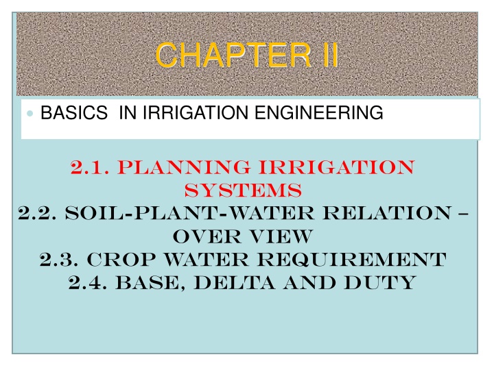
CHAPTER II BASICS IN IRRIGATION ENGINEERING 2.1. Planning Irrigation systems 2.2. soil-plant-water relation over view 2.3. Crop water requirement 2.4. Base, delta and duty
2.1. Planning Irrigation project What is Project planning? planning defines the project Project activities and end products that will be preferred (chosen) and describes how the activities will be accomplished.
2.1. Planning Irrigation project cont The purpose of project planning is: to define major task, estimate the time and resources required provide logical framework for management review, control and monitoring and evaluation purposes.
2.1. Planning Irrigation project cont Project planning activities and goals include defining: The specific work to be performed and goals that define and bind the project Estimates to be documented for planning, tracking and controlling the project Commitments that are planned, documented and agreed to by affected groups Project constraints alternatives, assumptions, and
2.1. Planning Irrigation project cont The planning process includes: steps to estimate the size of the project, estimate the technical scope of the effort, estimate the resources required to complete the project, produce a schedule, identify commitments and assess risks and negotiate
2.1. Planning Irrigation project cont What is a project plan ? A project plan is a formal, approved document that is used to manage and control a project. The project plan forms the basis for all management effort associated with the project, It is a document that is also expected to change overtime The project plan documents information associated with the project; it is not a verbose (wordy) textural document. The information associated with the plan evolves as the project moves through its various stages and is to be updated as a new information unfolds (give details of) about the project the pertinent
2.1. Planning Irrigation project cont Objectives of irrigation project planning To make the technical performance feasible Economically viable Environmental friendly Socially acceptable
Considerations in Planning Irrigation Systems 1. Location: The main point to consider in locating an irrigation project is the need to investigate available resources in the area. e.g. Climate, Land with good agricultural potential and good topography, Availability of labor (skilled and unskilled), Land tenure, Marketing, Transport facilities, etc.
Considerations cont 2. Crops to be grown: should be determined by available resources as well as marketability of the crops especially in terms of what people like to eat. 3. Water Supply: Consider a) Sources of water (b) Quantity and quality of water (c) Engineering works necessary to obtain water e.g. if underground, pumping is needed (d) Conveyance System: can be by gravity e.g. open channels or canals or by closed conduits e.g. pipes.
Considerations cont 4. Systems of Applying Water: e.g. Surface (90% worldwide), Sprinkler(5%), Trickle and Sub-irrigation(5%). 5. Water Demand: The water requirement for the given crop has to be determined. This is by calculating the evapotranspiration (to be treated later) 6.Project Management: Consider how to manage the irrigation system
Engineering design and phasing of irrigation design The preparation of the engineering design for an irrigation project is divided into three stages, Outline design / the study phase Preliminary design Final design Different levels of study Prefeasibility Feasibility Feasibility and design Detail design
Outline Design The outline design is the final result of the study phase (when no feasibility study is carried out) and is generally based on available topographic information. The map scale may be 1:25,000 or larger if available. No topographic surveys are executed to support this outline design. The outline design will result in a sketch layout delineating the approximate boundaries of the irrigation area and a canal layout plan. Contour information may give an indication of the ground slopes in the canal alignments.
Outline Design cont The main structures can already be indicated on the sketch layout. In the study phase provisional decisions are made on type and approximate location of the head works. Also the type of irrigation canal, earthen or lined will be provisionally decided upon, review of geological and soil conditions will present an insight in the geotechnical conditions to be expected. Presence of sufficient amounts of stone will indicate possibilities for the design of stone masonry structures.
Preliminary Design The objective of the preliminary design phase is to determine the location and levels of the head- works, irrigation and structures as well as areas served on preliminary basis. The results of the preliminary design will allow the accurate formulation of the detailed surveys and investigations required for the detailed design. The preliminary design is presented in a preliminary design report of prescribed layout will contain preliminary design drawings showing the approximate dimensions of irrigation structures and their layout. drainage canals and
Preliminary Design cont The preliminary design report will be similar to final design report and it shows the justification of the preliminary irrigation scheme and confirms its data base. The preliminary design starts with a review of the conclusions of the study phase. In this review the information from the topographic map and the land capability surveys are incorporated. Validity of the earlier drawn conclusions will be re-examined.
Preliminary Design cont Layout configuration check with the new topographic map; Location of the head works with a view to the required intake level and site map; Type of irrigation canals, earthen or lined, in view of soil conditions encountered; Suitability of the area for irrigated agriculture; Administrative boundaries; Consultation with village administration and farmers on alignments and boundaries; Existing irrigation;
Preliminary Design cont Residential occupation and other non-arable areas identified on the topographic map; Drainage conditions and cross-drainage requirements; Water balance computations with more accurate data on irrigated land and irrigation requirements; Selection of structure types and construction materials. Extensive field checking is required to resolve the above interests.
Preliminary Design cont Location of major structures and canal alignments shall be based on a survey of the alignment and the elevation of the canals by instrument. The results of this survey will be checked in the field by the accompanied by the geotechnical engineer and the topographical engineer. It will be used to ascertain the accuracy of the contour map and it will yield the final layout of the system. irrigation engineer
Final Design Final location and intake level at the head works are determined and incorporated in the headwork design. In this stage the layout, canal and structure drawings will be prepared in final detail. At the start of the final design the results of the previous surveys and investigations will be reviewed. The preliminary design will be checked with the results of the canal alignment surveys. The final canal centre lines and canal design water levels will be determined.
Final Design cont If the contour map does not deviate too much from the canal survey results, only minor adjustments in the layout and the canal alignment will be made. Before completing the layout map the irrigation engineer will inspect all canal alignments, the headwords site and the major structure sites in the field. Once layout and levels are finalized the detailed canal and structure design calculations will be completed together with all related drawing work. Detailed head-works design will be carried out once the final intake level and design discharge are determined.
Final Design cont The final design will be presented as a design report of prescribed layout and standard dimensions. It will contain the final design presented on drawings with completely detailed layouts, canal and structural drawings. Bill of Quantities Tender Documents Operation and maintenance manual
