Mineral Potential Assessment Techniques and Methods Explained
Comprehensive overview of mineral potential assessment methods using a mineral systems approach. Explore qualitative and quantitative approaches, GIS methods, and the assessment of mineral likelihood and prospects. Understand the advantages, disadvantages, and applications of different techniques for regional and local-scale exploration.
Download Presentation

Please find below an Image/Link to download the presentation.
The content on the website is provided AS IS for your information and personal use only. It may not be sold, licensed, or shared on other websites without obtaining consent from the author. Download presentation by click this link. If you encounter any issues during the download, it is possible that the publisher has removed the file from their server.
E N D
Presentation Transcript
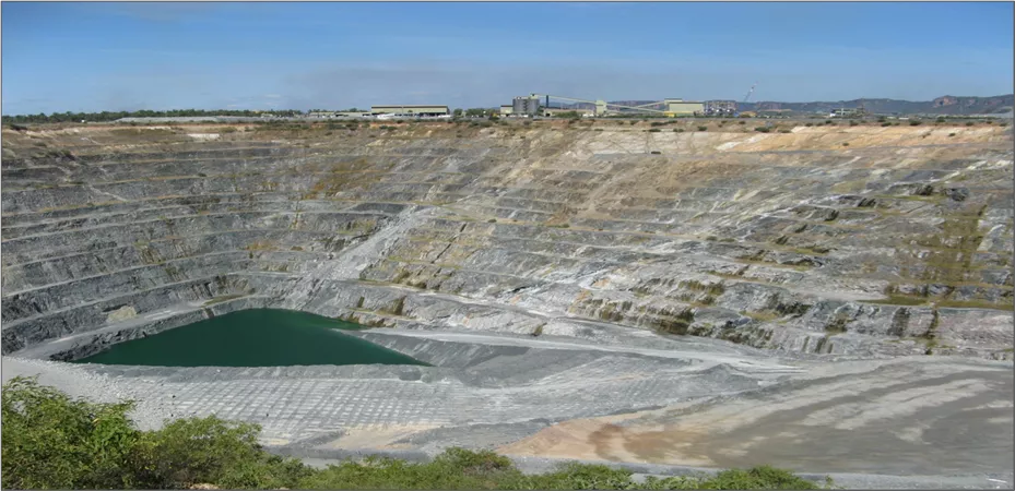
Methods of Mineral Potential Assessment: A Mineral Systems Approach Ranger
Outline Mineral potential assessment Methods of assessment (mineral potential, prospectivity, and favourability maps) Mineral-systems approach definition, advantages and disadvantages Lessons learnt and not learnt URAM 2014
Mineral potential Likelihood that an economic mineral deposits could have formed in the area Probabilistic approach to mineral deposits instead of deterministic Probabilities are conditional on geological processes occurring in an area on geological features indicative of those processes Probability of sandstone-hosted uranium deposits in an area process: transport of U geological features: leachable source of U; permeable sandstone; hydrogeological gradient Mineral potential assessment
Methods of assessment (Quantitative) Delineate areas permissive for a deposit Estimate number of deposits Estimate tonnage of metals at different probabilities Methods: NURE; 3- part USGS; Deposit density etc probability 90% 50% 10% Uranium (t) xx yy zz URAM 2014
Methods of assessment (Qualitative) Delineate areas permissive for a deposit Estimate and assign probabilities Non-numerical (high, moderate, low) Ordinal (numbers expressing ranking) Cardinal (numbers expressing quantities); can be computed by probability equations URAM 2014
GIS methods of assessment Methods are not quantitative but the method of visualisation is quantitative Produce favourability or prospectivity maps by estimating probabilities Dominantly data-driven and objective Techniques (see Bonham-Carter, 1994): Boolean logic Index overlay Bayesian (Weights of evidence) Fuzzy logic Mineral potential assessment
Which method and why Depends on the purpose/aim/objective Prospectivity map Favourability map For regional-scale exploration targeting qualitative (GIS-based) For local-scale brown-fields exploration qualitative (GIS-based) Competing land-use decisions quantitative qualitative Mineral potential map For mineral endowment and inventory quantitative Mineral potential assessment
Essential for qualitative and quantitative methods Delineation of permissive or favourable areas Using Features essential for a fertile mineralising process Identified in Mineral deposit models/types Or Mineral-systems URAM 2014
Mineral system: initial concept Wyborn et al (1994) Australian Proterozoic mineral system: essential ingredients and mappable criteria All geological factors that control generation and preservation of mineral deposits Stress on Processes Analogous to Petroleum Systems Emergence of Relational Databases and GISs URAM 2014
Seven important geological factors 1. Source of fluids and ligands 2. Source of metals and other components 3. Migration pathways (inflow and outflow zones) 4. Thermal gradients 5. Source of energy to transport fluid and metals 6. Mechanical and structural focusing mechanism at the trap site 7. Chemical and/or physical cause for precipitation at the trap site URAM 2014
Mineral system (Knox-Robinson & Wyborn, 1997) source-pathway-trap paradigm URAM 2014
Mineral potential assessment method Features Of Mineral System Mineral System combining 2 approaches Probabilistic + Setting Source Metal Ligand Energy Assess mineral potential (by computing probabilities) Identify mappable geological features Assign Pathway probabilities to mappable features Trap: Mechanical Chemical Timing Map: prospectivity, favourability, mineral potential Preservation
Assessments at various scales http://www.ga.gov.au/minerals/projects/conclude d-projects/mineral-potential.html http://www.ga.gov.au/minerals/projects/conclude d-projects/uranium-systems.html URAM 2014
Limitations of mineral-systems approach Preservation considered important but listed factors do not include features critical for preservation Age, duration and relative timing of events in a mineral system do not receive adequate attention Requires change to focus on giant instead of average-size deposits Requires rethinking to take in take into account clustering of deposits URAM 2014
4 regions with unconformity-related uranium Rum Jungle and S Alligator Valley different Alligator Rivers and Eastern Athabasca similar URAM 2014
Supergiant (Bull Elephant): Olympic Dam Prominent Hill (0.01 Mt U3O8; 1.5 Mt Cu; 115 t Au) Olympic Dam (2.24 Mt U3O8; 68 Mt Cu; 2480 t Au) Olympic Dam is larger than Prominent Hill: ~200 times for U ~45 times for Cu ~20 times for Au 0 25 50 100 Kilometers URAM 2014
Reliability or robustness of assessment Depends on Knowledge of mineral systems/deposit styles (their critical features) Identification of mappable signatures in datasets which correspond to critical features of mineral systems Extent and quality of datasets Mineral potential assessment
Conclusions Choice of methods depends on the objective Basics: Know your mineral system (deposit-type): SCIENCE Create useful datasets: A MUST Mineral system approach can be rewarding. For successful examples visit GA s website: http://www.ga.gov.au/minerals/projects/concluded-projects/mineral-potential.html; and http://www.ga.gov.au/minerals/projects/concluded-projects/uranium-systems.html Don t overdo or oversell it (only detailed exploration such as drilling can find a deposit) URAM 2014


